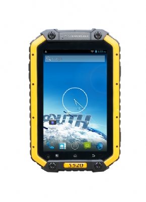
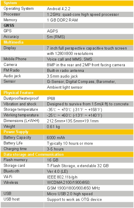
● 1.2 GHz quad-core processor
● 1 GB RAM, 16 GB ROM
● Android 4.2.2 operating system
● 7″ full perspective capacitive touch screen
● IP68 industrial standard designed
● 6000mAh built-in rechargeable battery
● USB host (OTG)
Description
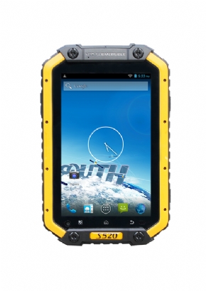
With industrial standard and high performance, SOUTH S520 is designed for ease of use GNSS receiving terminal, integrated with professional 1.2GHz quad-core processor, 1GB RAM and 16GB ROM, ensure that the software runs unobstructed and your demand of data storage.
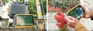
For data collection, inspection and maintenance, based on the most advanced and compatible Android 4.2.2 operating system, equipped with electric compass, Barometer and G-sensor, yet fully integrated with all the features you need in the field. South S520 tablet meets the challenge in GIS applications, provides a good platform of hardware and software, allows you to run the third-party software and customize GIS data collecting software. What’s more, with featuring the professional OS, you can bring your office to the field, collecting information, capturing photos and communicating with your team wherever you are, the office can get up to date from the field operations in real time.
With the rapid development of GIS industry, tablet has become a trend, it is widely used in utility companies, environmental management agencies, municipal administration, agriculture and forestry, Public Safety, transportations, Telecommunications, Natural Resources and other industries.
Meanwhile, the ultra-rugged frame with IP68 industrial level protection, the tablet offers everything you expect, it works well in extremely tough conditions like humidity extremes, vibration and shock. The more computing power and large size screen device, makes it easier to view and use detailed maps, which is a solution of GIS users have been looking for.
The third-party application
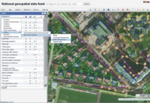
With the Android 4.2.2 platform, the tablet allows and is ready for installing third-party software or any necessary utility, upon which users may collect GIS information and maps via the GIS applications. For example, using Giscuit with S520 allows field staff to create, update, and analyze geographic information, the team can use geolocation to quickly zoom into their current location or attach a photo taken from the field in real time. In practical application, you will get all the advantages from S520 working with Giscuit.